MAPS
A GEOGRAPHICAL HISTORY OF THE STATE OF NEW YORK: EMBRACING ITS HISTORY, GOVERNMENT, PHYSICAL FEATURES, CLIMATE, GEOLOGY, MINERALOGY, BOTANY, ZOOLOGY, EDUCATION, INTERNAL IMPROVEMENTS, &C. WITH A SEPARATE MAP OF EACH COUNTY. THE WHOLE FORMING A COMPLETE HISTORY OF THE STATE. .
Utica, NY: H.H. Hawley & Co., 1848. [4], [xi]-xii, 13-432 pp., frontispiece illustration, several map illustrations and charts. Bound in original tooled leather [some wear, hinges starting but holding well], gilt spine title and decorative tooling. Decorative endpapers, early ownership signature of "William R. Cranston, Auburn, N.Y." on front endpaper..... More
AN INQUIRY INTO THE CONDITIONS RELATING TO THE WATER-SUPPLY OF THE CITY OF NEW YORK. AUGUST, 1900.
[New York: Isaac H. Blanchard Co, 1900]. Original green cloth [corners bumped, a bit of extremity wear, gilt spine lettering and front cover lettering dulled]. xxxix, 627pp. Many folding color maps, charts and illustrations. Two single-page printed items from the Merchants' Association laid in: [1] "The edition of this report..... More
REPORT OF THE SECRETARY OF WAR, COMMUNICATING ...A COPY OF THE REPORT OF THE SURVEY OF THE BOUNDARY LINE BETWEEN THE STATE OF MICHIGAN AND THE TERRITORY OF WISCONSIN. MARCH 8, 1842.
[Washington]: 1842. 27th Cong., 2d Sess. SD170. 12pp, disbound, one folding chart, one folding map. Light foxing, Very Good. More
MESSAGE FROM THE PRESIDENT...IN RELATION TO THE SURVEY TO ASCERTAIN AND DESIGNATE THE BOUNDARY-LINE BETWEEN THE STATE OF MICHIGAN AND THE TERRITORY OF WISKONSIN.
[Washington: 1841]. 26th Cong., 2d Sess. SD151. 16pp, 5 folding maps, Disbound, Very Good. More
MILLER'S NEW YORK AS IT IS; OR STRANGER'S GUIDE-BOOK TO THE CITIES OF NEW YORK, BROOKLYN AND ADJACENT PLACES: COMPRISING NOTICES OF EVERY OBJECT OF INTEREST TO STRANGERS; INCLUDING PUBLIC BUILDINGS, CHURCHES, HOTELS, PLACES OF AMUSEMENT, LITERARY INSTITUTIONS, ETC. WITH MAP AND NUMEROUS ILLUSTRATIONS.
New York: James Miller, 522 Broadway, 1859. 12mo. Contemporary cloth over stiff paper wrappers [hinges going, spine chipped], title stamped in gilt on front cover. Pages [18], [frontis plate of Cooper Union], 129, [3 advts], plus folding plates. In-text illustrations. Front and rear pastedowns consist of advertisements. A few leaves..... More
KEYSTONE UP-TO-DATE, INDEXED MAP OF MINNESOTA WITH LATEST OFFICIAL CENSUS SHOWING IN COMPLETE FORM ALL RAILROADS, CITIES, TOWNS, POST OFFICES, RIVERS, MONEY ORDER POST OFFICES, TELEGRAPH STATIONS AND CHIEF AUTO ROADS...
[np: 1916]. Original printed stiff paper wrappers, with large color folding map, index of places on its verso. Near Fine. More
THE STATE OF MISSISSIPPI, CLAIBORNE COUNTY: I, WILLIAM DAVIS, A DEPUTY SURVEYOR OF THE UNITED STATES FOR THE STATE OF MISSISSIPPI AFORESAID, DO CERTIFY THAT I HAVE SURVEYED BY THE DIRECTION OF WM. DOTSON, JAMES A. HUTCHINSON, DANICE WILLIS, RAYNARD TURPIN AND ELBERT SHELBY... A MERIDIAN LINE... TO THE SOUTH BOUNDARY OF SECTION NO. 55. IN THE SAME TOWNSHIP REPRESENTED BY A DOUBLE LINE IN THE ABOVE DIAGRAM, AND WHICH IS INTENDED TO REPRESENT THE EAST BOUNDARY OF MRS. HANNAH KENNISON'S DOWER OUT OF LANDS HER LATE HUSBAND ONCE OWNED WHICH SAID DOWER IS BY SAID COMMISSIONERS ESTIMATED TO CONTAIN ONE HUNDRED AND THIRTY ACRES. 19TH DAY OF MARCH, 1845. | WM. DAVIS, SURVEYOR, H. [On verso: PLAT OF MRS. KENNISON'S DOWER, &C., FEES, SURVEYING & PLAT, $16.00.
Claiborne County, MS: 1845. Folio manuscript broadside, 8" x 13", in a neat, legible hand. With a detailed plat drawing at head. Lightly tanned and worn. Small corner tear costing a couple of letters. A few expert tape repairs to fold splits [no text loss]. Good+. The document shows several..... More
BOUNDARY BETWEEN MISSOURI AND IOWA. LETTER FROM THE SECRETARY OF STATE, TRANSMITTING THE INFORMATION...RESPECTING THE BOUNDARY-LINE BETWEEN THE STATE OF MISSOURI AND THE TERRITORY OF IOWA.
25th Cong., 3d Sess. HD128. 1839. 24pp, disbound, lightly foxed. Two folding maps: Map Showing the Disputed Boundary of Missouri and Iowa; Indian Boundary Lines North of the Missouri River. Very Good. Albert Lea was appointed to "ascertain and mark the southern boundary-line of the Territory of Iowa." His report..... More
.jpg?width=320&height=427&fit=bounds&auto=webp&v=1711549254)
ACCOMPANIMENT TO MITCHELL'S NEW MAP OF TEXAS, OREGON, AND CALIFORNIA, WITH THE REGIONS ADJOINING.
Philadelphia: S. Agustus Mitchell, 1846 [i.e., 1925 "[Reproduced by North Pacific Bank Note Co.]" 34, [2 blanks] pp, with folding map, in color with decorative borders: "A New Map of Texas Oregon and California with the Regions Adjoining Compiled from the most recent authorities. . ." Very Good. The 1925..... More
LETTER FROM THE SECRETARY OF WAR, TRANSMITTING THE REPORT OF THE COMMISSIONERS APPOINTED TO EXAMINE THE MOLINE WATER-POWER.
45th Cong., 1st Sess. HED21. 1877. 44pp, Disbound, large folding map. Very Good. More
RAND, MCNALLY & CO. 'S INDEXED COUNTY AND TOWNSHIP POCKET MAP AND SHIPPERS' GUIDE OF MONTANA ACCOMPANIED BY A NEW AND ORIGINAL COMPILATION AND READY REFERENCE INDEX, SHOWING IN DETAIL THE ENTIRE RAILROAD SYSTEM. THE EXPRESS COMPANY DOING BUSINESS OVER EACH ROAD, AND ACCURATELY LOCATING ALL CITIES, TOWNS, POST OFFICES, RAILROAD STATIONS, VILLAGES, COUNTIES, ISLANDS, LAKES, RIVERS, ETC. THE SPECIAL FEATURES OF THIS POCKET MAP ARE: LOCATING THE NEAREST MAILING POINT OF ALL LOCAL PLACES; DESIGNATING MONEY-ORDER POST OFFICES; TELEGRAPH STATIONS; AND NAMING THE EXPRESS COMPANY DOING BUSINESS AT THE POINTS WHERE THE SEVERAL COMPANIES HAVE OFFICES.
[Chicago & NY: 1910]. Large folding color map. Original printed wrappers. 22, [8 advt.] pp. Very Good. More
RAND, MCNALLY INDEXED POCKET MAP AND SHIPPERS' GUIDE OF MONTANA.
[Chicago & New York: 1916]. Large folding color map. Original printed wrappers. 32, [2 advt.] pp. Good+ or so. More
THE MUTUAL LIFE INSURANCE COMPANY OF NEW YORK. REPORT, 1861. F. RATCHFORD STARR, AGENT, 400 WALNUT STREET.
[Philadelphia: 1861]. 87, [1 blank] pp. Original printed glossy wrappers, stitched. 16mo. Double-page color map frontis of the United States, showing the Company's seven Classes or Regions. Very Good. With the Company's 18th annual report, a report on the Company's progress "for the past Eight Years," reversionary values, tables, descriptions..... More
RAND, MCNALLY & CO'S INDEXED COUNTY AND RAILROAD POCKET MAP AND SHIPPERS' GUIDE OF NEW HAMPSHIRE...
Chicago and New York: [1888]. 4" x 6.5." Original printed wrappers, stitched. 24, [4] pp + attractive color folding map at rear. Very Good. More
.jpg?width=320&height=427&fit=bounds&auto=webp&v=1711463965)
MAP OF 104 VALUABLE BUILDING LOTS IN THE CITY OF NEW-HAVEN. THIS PROPERTY IS ABOUT 25 MINUTES WALK FROM THE COLLEGES AND PUBLIC SQUARE.
[New York: P.A. Mesier's Lith., 28 Wall St. c. mid-19th century]. Oblong engraved map, 22" x 30." Depicting Willow Street and Marion Street, New Haven, Connecticut, bounded by Dixwell Avenue and Canal Street. With inset of New Haven's "Public Square" and "Yale College." Old folds with fold splits. Good or..... More
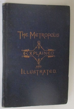
THE METROPOLIS EXPLAINED AND ILLUSTRATED IN FAMILIAR FORM, WITH A MAP.
New York: Devlin and Company, 1871. viii, [9]-61, [2 advts], [1 blank] pp. 4" x 6". Original cloth-covered wrappers with gilt lettering on front, blind stamped on back. Several text illustrations. LACKS the folding map. Light wear. Rubberstamps of "Peirce Watches and Jewelry...New Orleans, LA." Private bookplate on front pastedown..... More
ELECTION DISTRICTS OF THE SEVERAL ASSEMBLY DISTRICTS OF THE CITY AND COUNTY OF NEW YORK AND THE BOUNDARIES THEREOF, AS ESTABLISHED BY THE BOARD OF POLICE, JULY 22D, 1879.
New York: 1879. 116pp, stitched and early staples; some loosening of text. Blank portions of inner lower corners chewed on first few leaves. Original printed wrappers [worn, chipped]. Blank portions of title page with remnants of old newspaper clipping. The text is otherwise quite clean. More than 20 color maps..... More
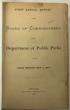
FIRST ANNUAL REPORT OF THE BOARD OF COMMISSIONERS OF THE DEPARTMENT OF PUBLIC PARKS FOR THE YEAR ENDING MAY 1, 1871.
New York: William C. Bryant & Co., 1871. vi, [2 blanks], 427, [1 blank] pp, plus illustrations. Text and maps, plates and photographs are present [pursuant to pages v-vi] except for "The Grotto Bridge Over the Ravine," which should appear opposite page 198. All three maps are torn with loss..... More
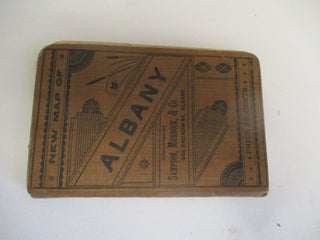
NEW MAP OF ALBANY...PRICE 25 CENTS.
Albany [NY]: Published by Sampson, Murdock, & Co., 448 Broadway, Albany, [1904?]. 4" x 6". 21, [1 blank] pp. Large 20" x 24" folding color map of the cities of Albany and Rensselaer, New York. Original printed cloth over stiff boards [back hinge cracked but holding, lightly dustsoiled and rubbed]..... More
OREGON. FACTS REGARDING ITS CLIMATE, SOIL, MINERAL AND AGRICULTURAL RESOURCES, MEANS OF COMMUNICATION, COMMERCE AND INDUSTRY, LAWS, ETC., ETC. FOR GENERAL INFORMATION. WITH MAP AND APPENDIX. THE STATE OF OREGON WAS DISTINGUISHED AT THE CENTENNIAL EXHIBITION BY MORE AWARDS FOR THE EXCELLENCE AND VARIETY OF ITS PRODUCTS THAN COMPARATIVELY ANY OTHER STATE.
New York City: Eastern Office, Oregon Railway and Navigation Co.; Franklin Press: Rand, Avery, & Co., Boston, 1880. 59, [1 blank] pp, large [17" x 19"] folding Colton color map of Oregon, Washington Territory, part of Idaho. A few short splits along folds with no loss. Original printed wrappers[soiled and..... More
RAND, MCNALLY & CO. 'S INDEXED COUNTY AND TOWNSHIP POCKET MAP AND SHIPPERS' GUIDE OF OREGON ACCOMPANIED BY A NEW AND ORIGINAL COMPILATION AND READY REFERENCE INDEX, SHOWING IN DETAIL THE ENTIRE RAILROAD SYSTEM. THE EXPRESS COMPANY DOING BUSINESS OVER EACH ROAD, AND ACCURATELY LOCATING ALL CITIES, TOWNS, POST OFFICES, RAILROAD STATIONS, VILLAGES, COUNTIES, ISLANDS, LAKES, RIVERS, ETC. THE SPECIAL FEATURES OF THIS POCKET MAP ARE: LOCATING THE NEAREST MAILING POINT OF ALL LOCAL PLACES; DESIGNATING MONEY-ORDER POST OFFICES; TELEGRAPH STATIONS; AND NAMING THE EXPRESS COMPANY DOING BUSINESS AT THE POINTS WHERE THE SEVERAL COMPANIES HAVE OFFICES.
[Chicago & NY: 1905]. Large folding color map [detached]. Original printed wrappers. 21, [9] pp. Light edge wear to text, Very Good. More
REPORT OF A GEOLOGICAL EXPLORATION OF PART OF IOWA, WISCONSIN, AND ILLINOIS...IN THE AUTUMN OF THE YEAR 1839; WITH CHARTS AND ILLUSTRATIONS.
[Washington]: June 11, 1844. 28th Cong., 1st Sess. SD407. Collated complete: 191pp + 25 maps and plates (many folding, some colored). Disbound, Very Good plus. The original 1840 printing did not include "the maps and illustrations which are to be found in the later editions and which are of considerable..... More
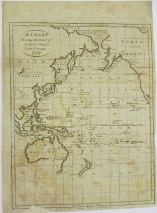
A CHART SHEWING THE TRACT OF CAPT. COOK'S LAST VOYAGE. 1799.
New York: Prepared for Payne's Geography, Published by J. Low, [1799]. Map, 8-1/2" x 11-3/4". Likely removed from a copy of John Payne's NEW AND COMPLETE SYSTEM OF UNIVERSAL GEOGRAPHY, VOL. IV, New York, 1799. Light wear. Small archival repair to bottom edge with only slight loss of map border..... More
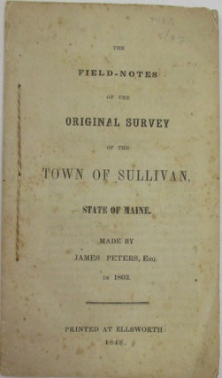
THE FIELD-NOTES OF THE ORIGINAL SURVEY OF THE TOWN OF SULLIVAN, STATE OF MAINE. MADE BY JAMES PETERS, ESQ. IN 1803.
Ellsworth [Maine]: 1848. 12mo. Stitched, 48pp. Very Good. A scarce Maine imprint, filled with dense surveyor's notes. Not in Williamson, Sabin, or at AAS's online site. OCLC 50201710 [4- all at institutions in the State of Maine] as of January 2022. More