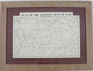
PLAN OF THE WESTERN SEAT OF WAR.
[New Orleans]: Published by H.P. Lathrop; Jules Manouvrier, Lithographer, [1861 or 1862]. Oblong 22" x 18-3/4". Map lithographed by Jules Manouvrier. Matted and housed in an attractive wood frame. Minor wear, Very Good. The map shows Kentucky, Tennessee, and portions of North Carolina, Mississippi, Illinois, Indiana, Ohio, Virginia; and an..... More