
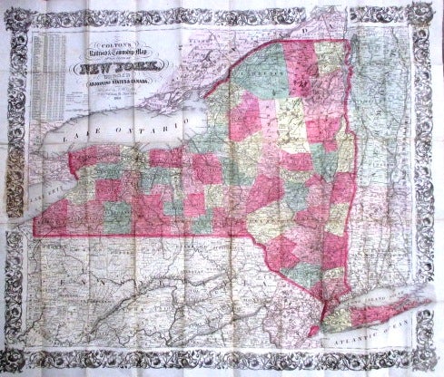
COLTON'S RAILROAD & TOWNSHIP MAP OF THE STATE OF NEW YORK, WITH PARTS OF THE ADJOINING STATES & CANADA.
New York: Published by J.H. Colton, 1865. 16mo cloth, with title stamped in gilt on front board [a bit shaken]. Folding pocket map, with full period color, details of railroad lines and networks, decorated borders. @27-1/2" x 23". Very Good, a few archival repairs on verso.
With statistical tables of population for New York counties. Item #32418
Price: $450.00