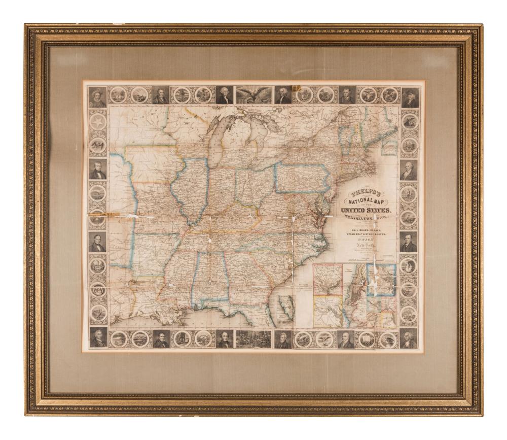
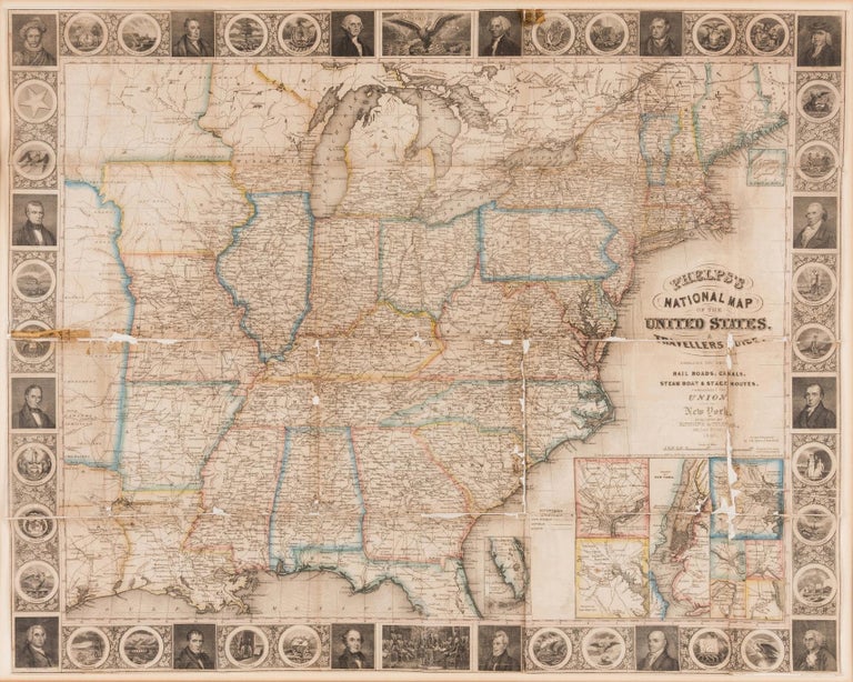
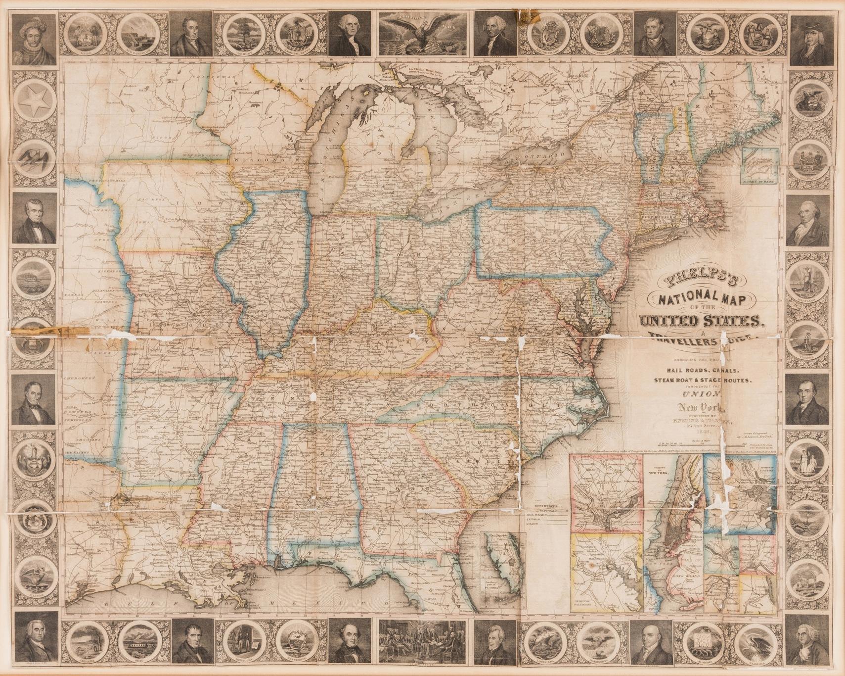
PHELPS'S NATIONAL MAP OF THE UNITED STATES, A TRAVELLER'S GUIDE.
New York: Ensign & Thayer, 1848. Steel-engraved hand-colored map of the United States within pictorial borders. 21" x 32." The map only is offered. Matted and framed [some loosening from the matting]. Separations with minor losses at folds, hence Good to Good plus only. Inset plans of Washington D. C., New York, Baltimore, Boston, Birmingham, Cincinnati, St. Louis, and Chicago.
This edition of the 1848 map is surrounded by pictorial borders depicting the State Seals of 30 States [including Texas], portraits of the Presidents, and portraits of Columbus and Lafayette. Border vignettes depict the Great Seal of the United States and the signing of the Declaration of Independence. An inset map depicts Boston, Philadelphia, New York and Baltimore. The map extends just past the Mississippi river into the Great Plains, and includes part of Texas and two unnamed regions extending north. Item #38010
Price: $750.00