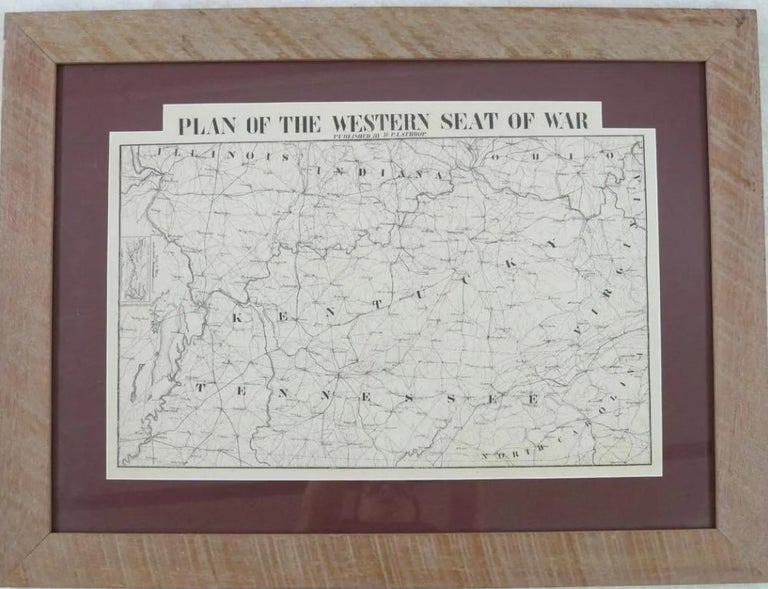
PLAN OF THE WESTERN SEAT OF WAR.
[New Orleans]: Published by H.P. Lathrop; Jules Manouvrier, Lithographer, [1861 or 1862]. Oblong 22" x 18-3/4". Map lithographed by Jules Manouvrier. Matted and housed in an attractive wood frame. Minor wear, Very Good.
The map shows Kentucky, Tennessee, and portions of North Carolina, Mississippi, Illinois, Indiana, Ohio, Virginia; and an inset entitled 'Reduced Continuation of Missouri R.', which lists 'J. Manouvrier & Co. Lith N.O.' Towns, railroad routes, rivers are depicted.
"Jules Manouvrier arrived in New Orleans from Prussia at the age of twenty-two in 1838 and remained there until he died in 1875. In addition to views of prominent buildings, he lithographed maps and numerous pieces of sheet music" [Jumonville, Set to Music: The Engravers, Artists, and Lithographers of New Orleans Sheet Music 131]. During the summer of 1861, Manouvrier was producing $5 and $10 Confederate notes for the CSA Treasury Department. During shipment of the $10 notes to Richmond, some were stolen after packages broke open in transit. The CSA Treasury was forced to destroy the entire issue of Manouvrier $10 notes so as not to undermine public confidence in the Treasury. [Hughes, Brent: "The 'Most Wanted' Confederate Note", The Virginia Numismatist, Volume 6, Number 1, 1970, pp. 12-13.]
Parrish & Willingham 6180. Stevenson [Second Edition] 75.6. Crandall 3053. Not in Jumonville or Thompson. Item #38192
Price: $1,500.00

